Dosiero:Denmark South Denmark location map.svg

Grando de tiu PNG antaŭprezento de tiu SVGa dosiero: 783 × 600 rastrumeroj. Aliaj distingivoj: 313 × 240 rastrumeroj | 627 × 480 rastrumeroj | 1 003 × 768 rastrumeroj | 1 280 × 980 rastrumeroj | 2 560 × 1 961 rastrumeroj | 1 000 × 766 rastrumeroj.
Bildo en pli alta difino (SVG-dosiero, 1 000 × 766 rastrumeroj, grandeco de dosiero: 252 KB)
| Jen dosiero de la Wikimedia-Komunejo. La priskribo en ties priskriba paĝo estas montrata suben.
|
Resumo
| Priskribo |
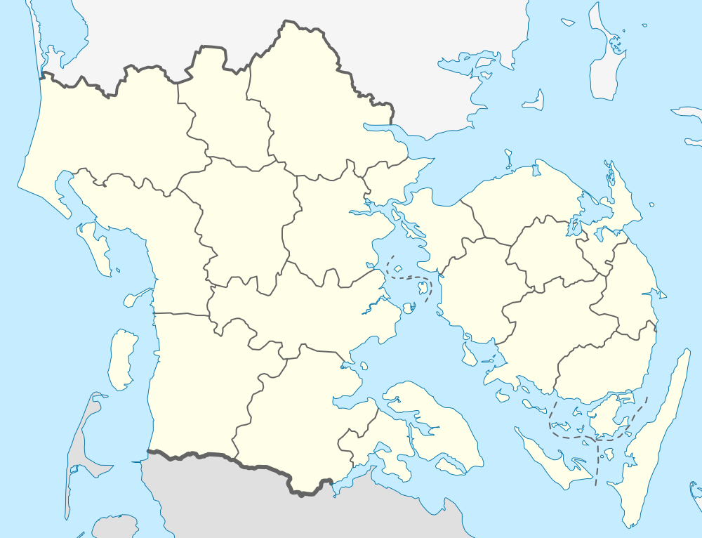
English: Location map of Region South Denmark in Denmark
Equirectangular projection, N/S stretching 177 %. Geographic limits of the map:
Deutsch: Positionskarte von der Region Syddanmark in Dänemark
Quadratische Plattkarte, N-S-Streckung 177 %. Geographische Begrenzung der Karte:
|
| Dato | |
| Fonto | Propra verko |
| Aŭtoro | Erik Frohne |
| SVG genesis |
Permesiloj:
Mi, la posedanto de la aŭtorrajto por ĉi tiu verko, ĉi-maniere publikigas ĝin laŭ la jenaj permesiloj:

|
Estas permesite kopii, disdoni kaj/aŭ redakti ĉi tiun dokumenton, sen senŝanĝaj sekcioj, sen antaŭkovrilaj kaj sen dorskovrilaj tekstoj, laŭ la kondiĉoj de la Permesilo GNU por Liberaj Dokumentoj, Versio 1.2 aŭ ajna pli nova versio eldonita de la Free Software Foundation; sen Senŝanĝaj Sekcioj, Antaŭovrilaj Tekstoj aŭ Malantaŭkovrilaj Tekstoj. Kopio de la permesilo estas inkluzivita en la sekcio titolita GNU Free Documentation License. |
Ĉi tiu dosiero estas disponebla laŭ la permesilo Krea Komunaĵo Atribuite-Samkondiĉe 3.0 Neadaptita.
- Vi rajtas:
- kunhavigi – kopii, distribui kaj publikigi la verkon
- aliigi – modifi, adapti, kompletigi, transformi, uzi la tutan verkon aŭ ties partojn, memstare aŭ en aliaj verkoj
- La verko rajtas esti kunhavigata nur:
- atribuite – Vi devas atribui aŭtorecon, liveri ligilon al la permesilo kaj marki ĉu ŝanĝoj estis faritaj. Faru tion en aprobinda maniero, tamen ne sugestante, ke permesinto aprobas vin aŭ vian uzon.
- samkondiĉe – Se vi rekombinas la verkon, transformas ĝin aŭ kreas devenaĵon bazitan sur ĝi, vi rajtas distribui la rezultan verkon nur laŭ la sama aŭ kongrua permesilo kompare kun ĉi tiu.
Vi povas elekti la permesilon preferatan.
Dosierhistorio
Alklaku iun daton kaj horon por vidi kiel la dosiero tiam aspektis.
| Dato/Horo | Bildeto | Grandecoj | Uzanto | Komento | |
|---|---|---|---|---|---|
| nun | 13:28, 13 jan. 2010 | | 1 000 × 766 (252 KB) | Erik Frohne | Reverted to version as of 18:51, 10 March 2009:Colors as agreed upon by german and french map makers. Use file Denmark South Denmark location map (da).svg instead if you need other colors |
| 01:36, 29 dec. 2009 |  | 783 × 600 (1,35 MB) | Hubertus45 | Changing colour after consensus with other users. | |
| 23:44, 14 dec. 2009 |  | 783 × 600 (1,35 MB) | Hubertus45 | Making the region more visible to the neighbour areas. | |
| 23:38, 14 dec. 2009 |  | 783 × 600 (1,35 MB) | Hubertus45 | Making the region more visible to the neighbour areas. | |
| 18:51, 10 mar. 2009 |  | 1 000 × 766 (252 KB) | Erik Frohne | {{Information |Description={{en|1=Location map of Region South Denmark in Denmark Equirectangular projection, N/S stretching 177 %. Geographic limits of the map: * N: 56.00° N * S: 54.70° N * W: 8.00° E * E: 11.00° E}} {{de|1=Positionskarte von der |
Dosiera uzado
La jenaj paĝoj ligas al ĉi tiu dosiero:
Suma uzado de la dosiero
La jenaj aliaj vikioj utiligas ĉi tiun dosieron:
- Uzado en ba.wikipedia.org
- Uzado en ce.wikipedia.org
- Uzado en de.wikipedia.org
- Skallingen
- Årø
- Avernakø
- Bågø
- Drejø
- Hjortø
- Lyø
- Koresand
- Jordsand
- Tornø
- Barsø
- Knivsberg
- Ny Lillebæltsbro
- Lillebæltsbroen
- Langelandsbroen
- Horne Land
- Helnæs
- Tåsinge
- Augustenborg Kommune
- Gram Kommune
- Als Sund
- Æbelø
- Schloss Sonderburg
- Sundeved
- Siø
- Rømø Havn
- Slivsø
- Birkholm (Insel)
- Wikipedia:Kartenwerkstatt/Positionskarten/Europa
- Sylt-Rømø-Wattenmeerbucht
- Blue Water Arena
- Dejrø
- Vorlage:Positionskarte Dänemark Syddanmark
- Haderslebener Damm
- Bjørnø
- Fænø
- Snævringen
- Skarø
- Strynø
- Egholm (Bågø)
- Brandsø
- Thurø
- Kalvø
- Romsø
- Ejlinge
Vidi plian ĝeneralan uzadon de ĉi tiu dosiero.