Dosiero:Liverpool Bay.png

Grandeco de ĉi antaŭvido: 800 × 593 rastrumeroj. Aliaj distingivoj: 320 × 237 rastrumeroj | 640 × 474 rastrumeroj | 1 024 × 759 rastrumeroj | 1 278 × 947 rastrumeroj.
Bildo en pli alta difino ((1 278 × 947 rastrumeroj, grandeco de dosiero: 1,84 MB, MIME-tipo: image/png))
| Jen dosiero de la Wikimedia-Komunejo. La priskribo en ties priskriba paĝo estas montrata suben.
|
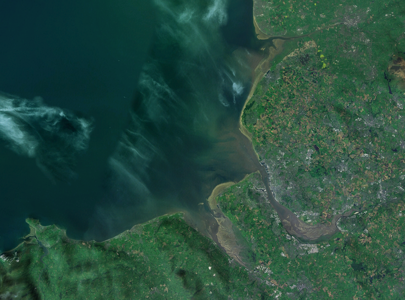
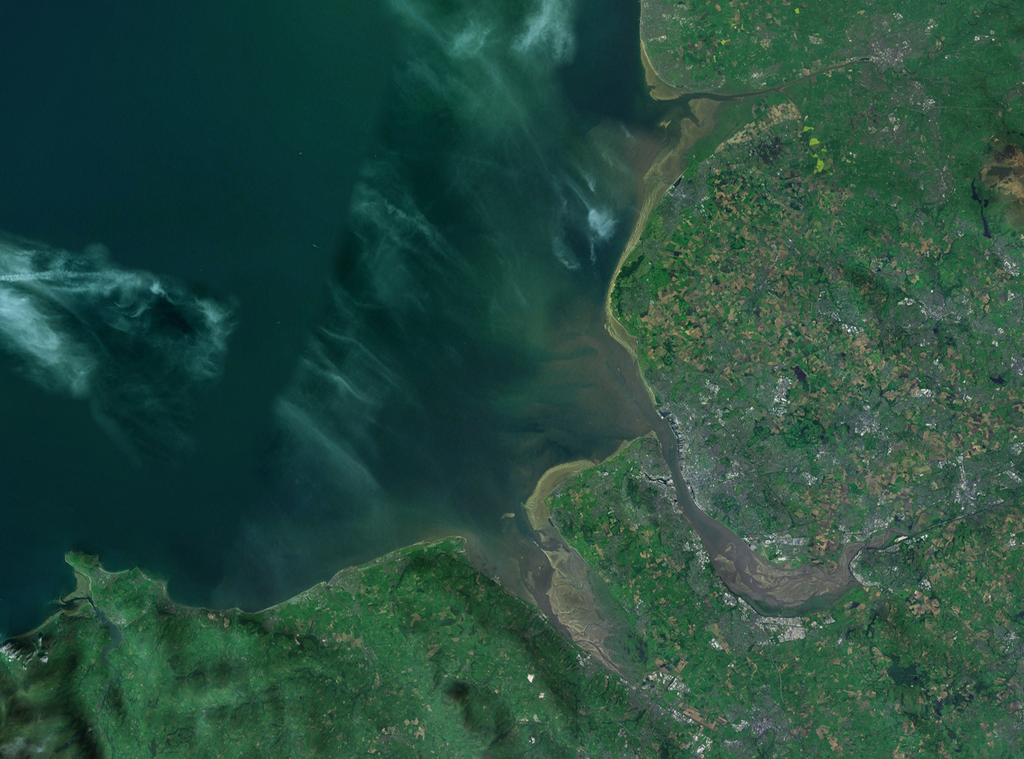
| Priskribo | A satellite photograph of Liverpool Bay, showing the West Lancashire Coastal Plain River Ribble at the top (north), the River Alt (hardly visble), River Mersey (centre) River Dee and the River Conwy in the south west. |
| Dato | |
| Fonto | NASA World Wind - Landsat 7 |
| Aŭtoro | Smurrayinchester |
| This image is in the public domain because it is a screenshot from NASA’s globe software World Wind using a public domain layer, such as Blue Marble, MODIS, Landsat, SRTM, USGS or GLOBE.
|
 |
| Pozicio de la fotilo | | Tiu cxi bildo kaj pliaj sur OpenStreetMap |
|---|

Dosierhistorio
Alklaku iun daton kaj horon por vidi kiel la dosiero tiam aspektis.
| Dato/Horo | Bildeto | Grandecoj | Uzanto | Komento | |
|---|---|---|---|---|---|
| nun | 14:06, 28 apr. 2007 | | 1 278 × 947 (1,84 MB) | Smurrayinchester | {{Information |Description=A satellite photograph of w:Liverpool Bay, showing the Rivers Dee and Mersey (centre), the River Alt (north) and the River Conwy (west). |Source=NASA World Wind - Landsat 7 |Date=28 April 2007 |Author= [[User:Smurrayincheste |
Dosiera uzado
La jena paĝo ligas al ĉi tiu dosiero:
Suma uzado de la dosiero
La jenaj aliaj vikioj utiligas ĉi tiun dosieron:
- Uzado en ca.wikipedia.org
- Uzado en ceb.wikipedia.org
- Uzado en cy.wikipedia.org
- Uzado en en.wikipedia.org
- Uzado en es.wikipedia.org
- Uzado en et.wikipedia.org
- Uzado en it.wikipedia.org
- Uzado en nl.wikipedia.org
- Uzado en nn.wikipedia.org
- Uzado en no.wikipedia.org
- Uzado en pl.wikipedia.org
- Uzado en pl.wiktionary.org
- Uzado en ru.wikipedia.org
- Uzado en sr.wikipedia.org
- Uzado en sv.wikipedia.org
- Uzado en vi.wikipedia.org
- Uzado en www.wikidata.org