Dosiero:Outer Hebrides UK relief location map.jpg

Grandeco de ĉi antaŭvido: 456 × 600 rastrumeroj. Aliaj distingivoj: 182 × 240 rastrumeroj | 365 × 480 rastrumeroj | 584 × 768 rastrumeroj | 778 × 1 024 rastrumeroj | 2 001 × 2 632 rastrumeroj.
Bildo en pli alta difino ((2 001 × 2 632 rastrumeroj, grandeco de dosiero: 481 KB, MIME-tipo: image/jpeg))
| Jen dosiero de la Wikimedia-Komunejo. La priskribo en ties priskriba paĝo estas montrata suben.
|
| Priskribo |
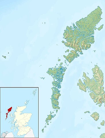
Relief map of the Outer Hebrides (excluding Sula Sgeir), UK. Equirectangular map projection on WGS 84 datum, with N/S stretched 180% Geographic limits:
|
| Dato | |
| Fonto |
|
| Aŭtoro | Nilfanion, created using Ordnance Survey data |
| Permeso (Reuzo de la dosiero) |
Ĉi tiu dosiero estas disponebla laŭ la permesilo Krea Komunaĵo Atribuite-Samkondiĉe 3.0 Neadaptita. Atribuite: Contains Ordnance Survey data © Crown copyright and database right
|
| Ceteraj versioj | File:Outer Hebrides UK blank map.svg - Blank map |
Dosierhistorio
Alklaku iun daton kaj horon por vidi kiel la dosiero tiam aspektis.
| Dato/Horo | Bildeto | Grandecoj | Uzanto | Komento | |
|---|---|---|---|---|---|
| nun | 12:26, 30 nov. 2011 | | 2 001 × 2 632 (481 KB) | Nilfanion | {{Information |Description=Relief map of the Outer Hebrides (excluding Sula Sgeir), UK. Equirectangular map projection on WGS 84 datum, with N/S stretched 180% Geographic limits: *West: 8.70W *East: 6.10W *North: 58 |
Dosiera uzado
La jenaj paĝoj ligas al ĉi tiu dosiero:
Suma uzado de la dosiero
La jenaj aliaj vikioj utiligas ĉi tiun dosieron:
- Uzado en ar.wikipedia.org
- Uzado en bg.wikipedia.org
- Uzado en ceb.wikipedia.org
- Uzado en da.wikipedia.org
- Uzado en de.wikipedia.org
- Soay (St. Kilda)
- Hirta
- Uist
- Boreray (St. Kilda)
- Uig (Lewis)
- Dùn
- North Rona
- Sula Sgeir
- Stac Lee
- Stac an Armin
- Barra Head (Schottland)
- Loch Druidibeag
- Lewis and Harris
- Seaforth Island
- Haskeir
- Vorlage:Positionskarte Schottland Outer Hebrides
- Stiaraval
- Ruaval
- Heaval
- Ben Tangaval
- Beinn Sciathan
- Eriskay-Sund
- Acairseid Mhor
- Berneray-Sund
- Loch Borve
- Loch Beag Bhuirgh
- Loch Bhrusda
- Borve Hill
- Beinn Shleibhe
- Loch Seaforth
- Loch Odhairn
- Scarp
- Fladday
- Sound of Scarp
- Loch Langavat
- Mealasta
- Little Bernera
- Flodaigh
- Flodaigh (Bernera)
- Bearasay
- Seanna Chnoc
- Kealasay
- Campay
- Craigeam
Vidi plian ĝeneralan uzadon de ĉi tiu dosiero.