Dosiero:1800 Wilkinson Map of the 4 Eastern Churches rectified.jpg

Bildo en pli alta difino ((1 678 × 1 308 rastrumeroj, grandeco de dosiero: 895 KB, MIME-tipo: image/jpeg))
| Jen dosiero de la Wikimedia-Komunejo. La priskribo en ties priskriba paĝo estas montrata suben.
|
| Priskribo |
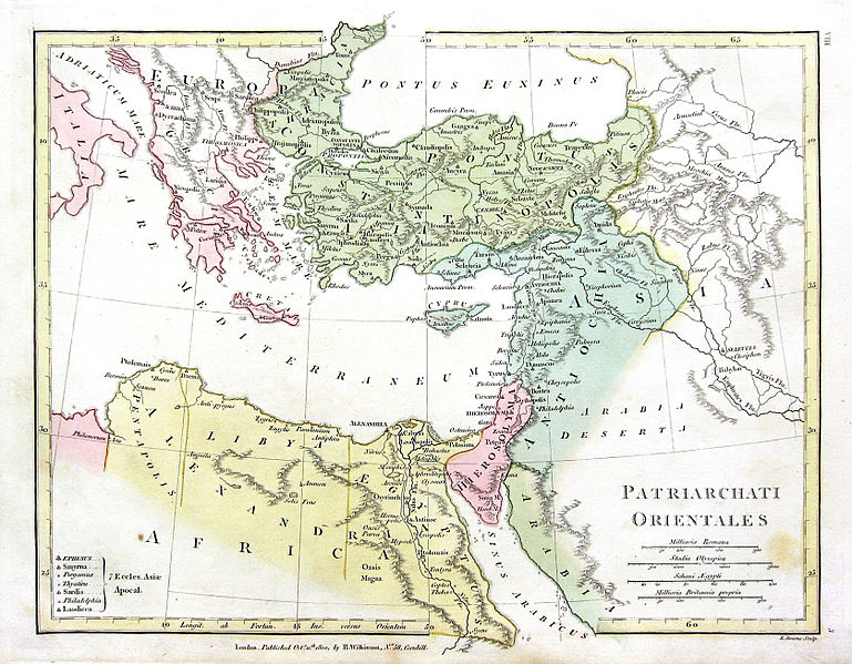
English: Map of the 4 Eastern Churches in the Pentarchy, circa 500CE |
| Dato | (UTC) |
| Fonto | |
| Aŭtoro |
La originala alŝutanto estis Fredrick Wilhelm de angla Vikipedio
|
| Ĉi tio estas modifita bildo, kio signifas, ke ĝi ekestis per cifereca aliigo de la origina versio. Modifoj: Rectified, cropped, colors corrected. La originaĵo videblas ĉi tie: 1800 Wilkinson Map of the 4 Eastern Churches.jpg. La modifojn faris MichaelBueker.
|
|
Tiu ĉi verko estas publika havaĵo en tiuj landoj, kies kopirajtado validas por longo de vivo plus 70 jaroj aŭ malpli.
| |
| Estis konkludite ke uzon de ĉi tiu dosiero limigas neniu konata aŭtorrajta leĝo, kio inkluzivas ĉiujn rilatajn kaj apudajn rajtojn. | |
Originala alŝutada protokolo
This image is a derivative work of the following images:
- File:1800_Wilkinson_Map_of_the_4_Eastern_Churches.jpg licensed with Cc-pd-mark-footer, PD-old
- 2010-08-24T08:50:03Z File Upload Bot (Magnus Manske) 1802x1378 (2039705 Bytes) {{BotMoveToCommons|en.wikipedia|year={{subst:CURRENTYEAR}}|month={{subst:CURRENTMONTHNAME}}|day={{subst:CURRENTDAY}}}} {{Information |Description={{en|Map of the 4 Eastern Churches in the Pentarchy, circa 500CE}} |Source=Tra
Uploaded with derivativeFX
Dosierhistorio
Alklaku iun daton kaj horon por vidi kiel la dosiero tiam aspektis.
| Dato/Horo | Bildeto | Grandecoj | Uzanto | Komento | |
|---|---|---|---|---|---|
| nun | 20:47, 10 feb. 2016 | | 1 678 × 1 308 (895 KB) | Чръный человек | обработка |
| 18:04, 9 feb. 2016 |  | 1 678 × 1 308 (1,22 MB) | Чръный человек | Осветление | |
| 20:29, 1 maj. 2011 |  | 1 678 × 1 308 (1,91 MB) | MichaelBueker | color touchup | |
| 20:14, 1 maj. 2011 |  | 1 678 × 1 308 (1,61 MB) | MichaelBueker | {{Information |Description={{en|Map of the 4 Eastern Churches in the Pentarchy, circa 500CE}} |Source=*File:1800_Wilkinson_Map_of_the_4_Eastern_Churches.jpg |Date=2011-05-01 20:13 (UTC) |Author=*[[:File:1800_Wilkinson_Map_of_the_4_Eastern_Churches.j |
Dosiera uzado
La jena paĝo ligas al ĉi tiu dosiero:
Suma uzado de la dosiero
La jenaj aliaj vikioj utiligas ĉi tiun dosieron:
- Uzado en ar.wikipedia.org
- Uzado en arz.wikipedia.org
- Uzado en az.wikipedia.org
- Uzado en bg.wikipedia.org
- Uzado en bn.wikipedia.org
- Uzado en ckb.wikipedia.org
- Uzado en cs.wikipedia.org
- Uzado en el.wikipedia.org
- Uzado en en.wikipedia.org
- Uzado en es.wikipedia.org
- Uzado en fa.wikipedia.org
- Uzado en fr.wikipedia.org
- Uzado en hu.wikipedia.org
- Uzado en id.wikipedia.org
- Uzado en it.wikipedia.org
- Uzado en ko.wikipedia.org
- Uzado en mk.wikipedia.org
- Uzado en ml.wikipedia.org
- Uzado en pt.wikipedia.org
- Uzado en ru.wikipedia.org
- Uzado en sk.wikipedia.org
- Uzado en sr.wikipedia.org
- Uzado en sv.wikipedia.org
- Uzado en tr.wikipedia.org
- Uzado en uk.wikipedia.org
- Uzado en zh-min-nan.wikipedia.org
Vidi plian ĝeneralan uzadon de ĉi tiu dosiero.