Dosiero:Chernihiv oblast detail map.png
Chernihiv_oblast_detail_map.png ((362 × 398 rastrumeroj, grandeco de dosiero: 27 KB, MIME-tipo: image/png))
| Jen dosiero de la Wikimedia-Komunejo. La priskribo en ties priskriba paĝo estas montrata suben.
|
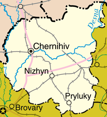
Map of Chernihiv Oblast, Ukraine
Adapted from http://www.un.org/Depts/Cartographic/map/profile/ukraine.pdf
http://en.wikipedia.org/wiki/Image:Chernihiv_oblast_detail_map.png
| This image is a map derived from a United Nations map.
Unless stated otherwise, UN maps are to be considered in the public domain. This applies worldwide. UN maps are, in principle, open source material and you can use them in your work or for making your own map. UN requests however that you delete the UN name, logo and reference number upon any modification to the map. Content of your map will be your responsibility. You can state in your publication, if you wish, something like: based on UN map … (map name, map number, revision number and date). See: Geospatial Information Section. And: Geospatial, location data for a better world. |
 |
Dosierhistorio
Alklaku iun daton kaj horon por vidi kiel la dosiero tiam aspektis.
| Dato/Horo | Bildeto | Grandecoj | Uzanto | Komento | |
|---|---|---|---|---|---|
| nun | 23:50, 22 mar. 2006 | | 362 × 398 (27 KB) | Fernando S. Aldado~commonswiki | Map of Chernihiv Oblast, Ukraine Adapted from http://www.un.org/Depts/Cartographic/map/profile/ukraine.pdf http://en.wikipedia.org/wiki/Image:Chernihiv_oblast_detail_map.png {{UN_map}} |
Dosiera uzado
La jena paĝo ligas al ĉi tiu dosiero:
Suma uzado de la dosiero
La jenaj aliaj vikioj utiligas ĉi tiun dosieron:
- Uzado en azb.wikipedia.org
- Uzado en bs.wikipedia.org
- Uzado en fa.wikipedia.org
- Uzado en nn.wikipedia.org
- Uzado en pt.wikipedia.org
- Uzado en sco.wikipedia.org
- Uzado en sr.wikipedia.org