Dosiero:Ille-et-Vilaine department location map.svg

Grando de tiu PNG antaŭprezento de tiu SVGa dosiero: 461 × 599 rastrumeroj. Aliaj distingivoj: 185 × 240 rastrumeroj | 369 × 480 rastrumeroj | 591 × 768 rastrumeroj | 788 × 1 024 rastrumeroj | 1 576 × 2 048 rastrumeroj | 856 × 1 112 rastrumeroj.
Bildo en pli alta difino (SVG-dosiero, 856 × 1 112 rastrumeroj, grandeco de dosiero: 202 KB)
| Jen dosiero de la Wikimedia-Komunejo. La priskribo en ties priskriba paĝo estas montrata suben.
|
Resumo
| Pozicio de la fotilo | | Tiu cxi bildo kaj pliaj sur OpenStreetMap |
|---|
| Priskribo |
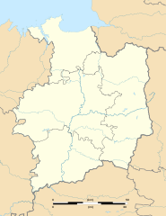
English: Blank administrative map of the department of Ille-et-Vilaine, France, for geo-location purpose, with distinct boundaries for regions, departments and arrondissements.
Français : Carte administrative vierge du département de l'Ille-et-Vilaine, France, destinée à la géolocalisation, avec limite distincte des régions, départements et arrondissements. Equirectangular projection, WGS84 datum
Geographic limits of the map:
|
||
| Dato | |||
| Fonto |
Propra verko
|
||
| Aŭtoro | Eric Gaba (Sting - fr:Sting) | ||
| Permeso (Reuzo de la dosiero) |
|
||
| Ceteraj versioj |
|

Permesiloj:
Mi, la posedanto de la aŭtorrajto por ĉi tiu verko, ĉi-maniere publikigas ĝin laŭ la jenaj permesiloj:
Ĉi tiu dosiero estas disponebla laŭ la permesilo Krea Komunaĵo Atribuite-Samkondiĉe 3.0 Neadaptita.
- Vi rajtas:
- kunhavigi – kopii, distribui kaj publikigi la verkon
- aliigi – modifi, adapti, kompletigi, transformi, uzi la tutan verkon aŭ ties partojn, memstare aŭ en aliaj verkoj
- La verko rajtas esti kunhavigata nur:
- atribuite – Vi devas atribui aŭtorecon, liveri ligilon al la permesilo kaj marki ĉu ŝanĝoj estis faritaj. Faru tion en aprobinda maniero, tamen ne sugestante, ke permesinto aprobas vin aŭ vian uzon.
- samkondiĉe – Se vi rekombinas la verkon, transformas ĝin aŭ kreas devenaĵon bazitan sur ĝi, vi rajtas distribui la rezultan verkon nur laŭ la sama aŭ kongrua permesilo kompare kun ĉi tiu.

|
Estas permesite kopii, disdoni kaj/aŭ redakti ĉi tiun dokumenton, sen senŝanĝaj sekcioj, sen antaŭkovrilaj kaj sen dorskovrilaj tekstoj, laŭ la kondiĉoj de la Permesilo GNU por Liberaj Dokumentoj, Versio 1.2 aŭ ajna pli nova versio eldonita de la Free Software Foundation; sen Senŝanĝaj Sekcioj, Antaŭovrilaj Tekstoj aŭ Malantaŭkovrilaj Tekstoj. Kopio de la permesilo estas inkluzivita en la sekcio titolita GNU Free Documentation License. |
Vi povas elekti la permesilon preferatan.
Dosierhistorio
Alklaku iun daton kaj horon por vidi kiel la dosiero tiam aspektis.
| Dato/Horo | Bildeto | Grandecoj | Uzanto | Komento | |
|---|---|---|---|---|---|
| nun | 21:05, 29 okt. 2010 | | 856 × 1 112 (202 KB) | Pymouss | Update: new arrondissement limits Mise à jour : nouvelles limites d'arrondissements |
| 13:44, 12 aŭg. 2008 |  | 856 × 1 112 (243 KB) | Sting | == Summary == {{Location|48|09|00|N|01|39|00|W|scale:1000000}} <br/> {{Information |Description={{en|Blank administrative map of the department of Ille-et-Vilaine, France, for geo-location purpose, with distinct boundaries for regi |
Dosiera uzado
La jenaj paĝoj ligas al ĉi tiu dosiero:
- Betton
- Betton (stacidomo)
- Bonnemain
- Bonnemain (stacidomo)
- Breteil
- Breteil (stacidomo)
- Bruz (stacidomo)
- Cesson-Sévigné (stacidomo)
- Chevaigné
- Chevaigné (stacidomo)
- Châteaubourg (stacidomo)
- Combourg (stacidomo)
- Corps-Nuds
- Corps-Nuds (stacidomo)
- Dingé
- Dingé (stacidomo)
- Dol-de-Bretagne
- Dol-de-Bretagne (stacidomo)
- Fougeray - Langon (stacidomo)
- Fougères (stacidomo)
- Gaël (Ille-et-Vilaine)
- Gaël (stacidomo)
- Grand-Fougeray
- Guichen - Bourg-des-Comptes (stacidomo)
- Guipry
- Guipry-Messac
- Gérard (stacidomo)
- Ille-et-Vilaine
- Janzé
- Janzé (stacidomo)
- Ker Lann (stacidomo)
- L'Hermitage
- L'Hermitage - Mordelles (stacidomo)
- La Brohinière (stacidomo)
- La Fresnais
- La Fresnais (stacidomo)
- La Gouesnière
- La Gouesnière - Cancale - Saint-Méloir-des-Ondes (stacidomo)
- La Poterie (stacidomo)
- Laillé
- Laillé (stacidomo)
- Langon (Ille-et-Vilaine)
- Le Theil-de-Bretagne
- Le Theil-de-Bretagne (stacidomo)
- Les Lacs (stacidomo)
- Listo de lumturoj en Bretonio
- Martigné-Ferchaud
- Martigné-Ferchaud (stacidomo)
- Messac (Ille-et-Vilaine)
- Messac - Guipry (stacidomo)
- Miniac-Morvan
- Miniac (stacidomo)
- Montauban-de-Bretagne
- Montauban-de-Bretagne (stacidomo)
- Montfort-sur-Meu
- Montfort-sur-Meu (stacidomo)
- Montreuil-sous-Pérouse
- Montreuil-sur-Ille
- Montreuil-sur-Ille (stacidomo)
- Mordelles
- Noyal - Acigné (stacidomo)
- Pleine-Fougères
- Pleine-Fougères (stacidomo)
- Plerguer
- Plerguer (stacidomo)
- Pléchâtel (stacidomo)
- Pontchaillou (stacidomo)
- Quédillac (stacidomo)
- Redon (stacidomo)
- Rennes (stacidomo)
- Retiers
- Retiers (stacidomo)
- Saint-Armel (Ille-et-Vilaine)
- Saint-Armel (stacidomo)
- Saint-Aubin-des-Landes
- Saint-Germain-sur-Ille
- Saint-Germain-sur-Ille (stacidomo)
- Saint-Gilles (Ille-et-Vilaine)
- Saint-Jacques-de-la-Lande
- Saint-Jacques-de-la-Lande (stacidomo)
- Saint-Malo (stacidomo)
- Saint-Médard-sur-Ille
- Saint-Médard-sur-Ille (stacidomo)
- Saint-Méen (stacidomo)
- Saint-Méloir-des-Ondes
- Saint-Senoux
- Saint-Senoux - Pléchâtel (stacidomo)
- Servon-sur-Vilaine
- Servon (stacidomo)
- Vern-sur-Seiche
- Vern (stacidomo)
- Vitré (stacidomo)
- Ŝablono:Geokesto lokumilo Ille-et-Vilaine
- Ŝablono:Mapo/Francio Ille-et-Vilaine
- Ŝablono:Mapo/Francio Ille-et-Vilaine Lumturoj
- Ŝablono:Situo sur mapo Francio Ille-et-Vilaine
Suma uzado de la dosiero
La jenaj aliaj vikioj utiligas ĉi tiun dosieron:
- Uzado en als.wikipedia.org
- Uzado en ar.wikipedia.org
- Uzado en ceb.wikipedia.org
- Uzado en cs.wikipedia.org
- Uzado en cy.wikipedia.org
- Uzado en de.wikipedia.org
- Uzado en en.wikipedia.org
- Uzado en fa.wikipedia.org
- Uzado en frr.wikipedia.org
- Uzado en fr.wikipedia.org
- Campus de Ker Lann
- École normale supérieure de Rennes
- Saint-Aubin-du-Pavail
- Abbaye Saint-Sauveur de Redon
- Menhir de Champ-Dolent
- Château de Bonnefontaine
- Saint-Pierre-de-Plesguen
- Saint-Servan
- Paramé
- Roazhon Park
- Tressé
- Château des Rochers-Sévigné
- Affaire Francisco Arce Montes
- Château de Vitré
- Antrain
- Argentré-du-Plessis
- Baillé
- Vendel
- Campel
- Chancé
- La Chapelle-du-Lou
- Dompierre-du-Chemin
- La Fontenelle (Ille-et-Vilaine)
- Guipry
- Le Lou-du-Lac
- Luitré
- Maure-de-Bretagne
- Messac (Ille-et-Vilaine)
- Montauban-de-Bretagne (commune déléguée)
- Ossé
- Piré-sur-Seiche
- Saint-Brice-en-Coglès
- Saint-Étienne-en-Coglès
- Saint-Georges-de-Chesné
- Saint-Jean-sur-Couesnon
Vidi plian ĝeneralan uzadon de ĉi tiu dosiero.