Dosiero:KBMG1477.png

Jen estas la maksimuma distingivo de la supra bildo.
KBMG1477.png ((243 × 272 rastrumeroj, grandeco de dosiero: 123 KB, MIME-tipo: image/png))
| Jen dosiero de la Wikimedia-Komunejo. La priskribo en ties priskriba paĝo estas montrata suben.
|
Resumo
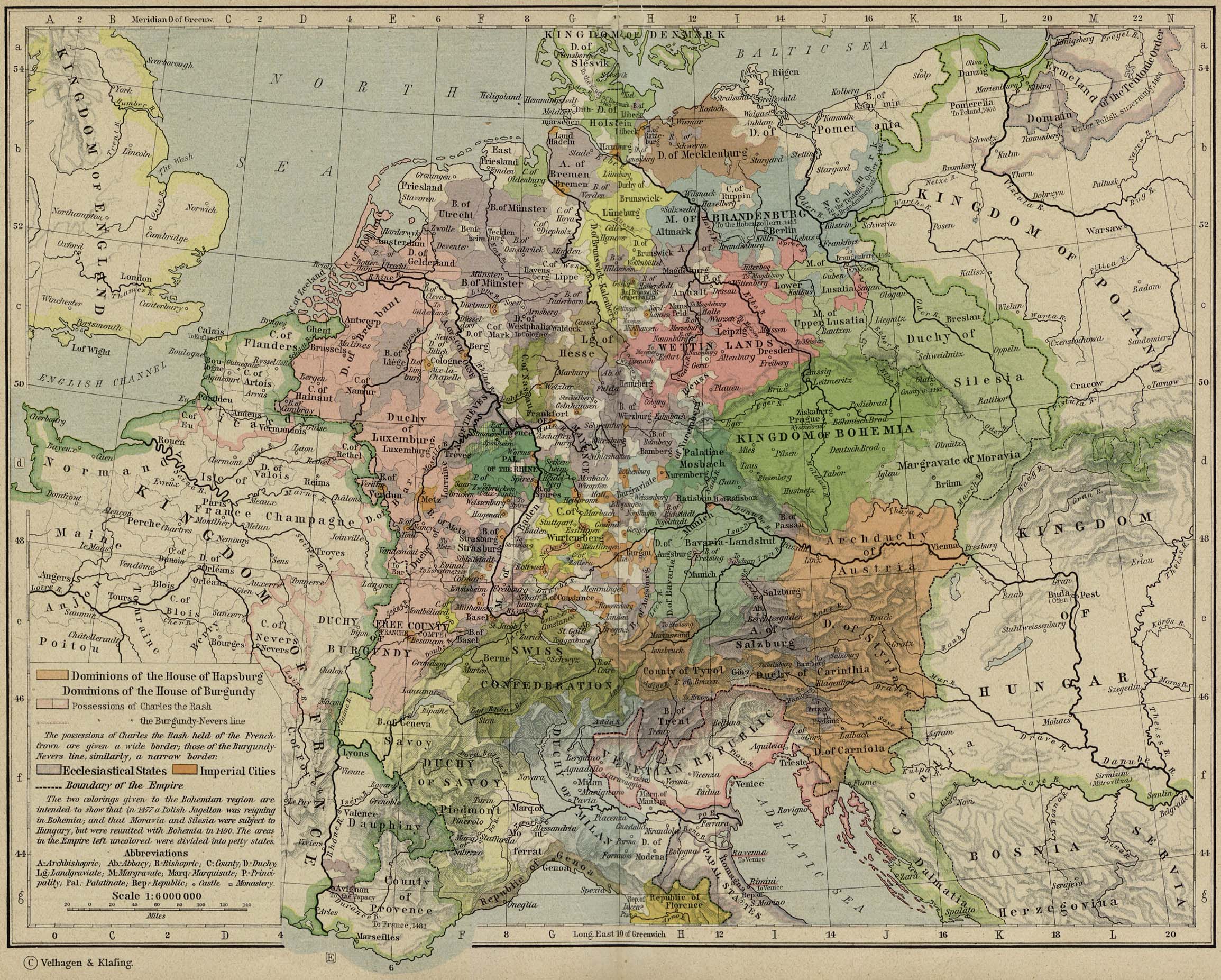
| Priskribo |
|
| Dato | |
| Fonto | from Historical Atlas by William R. Shepherd, 1926. |
| Aŭtoro | de:Velhagen & Klasing |
Permesiloj:
Tiu ĉi verko estas publika havaĵo en tiuj landoj, kies kopirajtado validas por longo de vivo plus 80 jaroj aŭ malpli. | |
| Estis konkludite ke uzon de ĉi tiu dosiero limigas neniu konata aŭtorrajta leĝo, kio inkluzivas ĉiujn rilatajn kaj apudajn rajtojn. | |
This work is in the public domain because it was published in the United States between 1929 and 1963, and although there may or may not have been a copyright notice, the copyright was not renewed. For further explanation, see Commons:Hirtle chart and the copyright renewal logs. Note that it may still be copyrighted in jurisdictions that do not apply the rule of the shorter term for US works (depending on the date of the author's death), such as Canada (70 years p.m.a.), Mainland China (50 years p.m.a., not Hong Kong or Macao), Germany (70 years p.m.a.), Mexico (100 years p.m.a.), Switzerland (70 years p.m.a.), and other countries with individual treaties.
|
 |
Originala alŝutada protokolo
- Uploadé sur Wikipédia NL par User:Känsterle le 17 décembre 2005.
Dosierhistorio
Alklaku iun daton kaj horon por vidi kiel la dosiero tiam aspektis.
| Dato/Horo | Bildeto | Grandecoj | Uzanto | Komento | |
|---|---|---|---|---|---|
| nun | 11:35, 25 feb. 2006 | | 243 × 272 (123 KB) | Odejea | Carte des duchés de Clèves, Berg, la Mark et Juliers, en 1477 Origine : * collection de cartes de l'Université du Texas (http://www.lib.utexas.edu/maps/). Ces cartes sont dans le domaine public (http://www.lib.utexas.edu/maps/faq.html#3.html). * uplo |
Dosiera uzado
La jena paĝo ligas al ĉi tiu dosiero:
Suma uzado de la dosiero
La jenaj aliaj vikioj utiligas ĉi tiun dosieron:
- Uzado en ast.wikipedia.org
- Uzado en azb.wikipedia.org
- Uzado en bg.wikipedia.org
- Uzado en br.wikipedia.org
- Uzado en ca.wikipedia.org
- Uzado en en.wikipedia.org
- Uzado en et.wikipedia.org
- Uzado en fr.wikipedia.org
- Uzado en it.wikipedia.org
- Uzado en ja.wikipedia.org
- Uzado en nl.wikipedia.org
- Uzado en no.wikipedia.org
- Uzado en pl.wikipedia.org
- Uzado en pt.wikipedia.org
- Uzado en ru.wikipedia.org
- Uzado en th.wikipedia.org
- Uzado en zh.wikipedia.org