Dosiero:Map of North Carolina NA.png
Grandeco de ĉi antaŭvido: 776 × 600 rastrumeroj. Aliaj distingivoj: 311 × 240 rastrumeroj | 621 × 480 rastrumeroj | 994 × 768 rastrumeroj | 1 280 × 989 rastrumeroj | 2 122 × 1 640 rastrumeroj.
Bildo en pli alta difino ((2 122 × 1 640 rastrumeroj, grandeco de dosiero: 1,21 MB, MIME-tipo: image/png))
| Jen dosiero de la Wikimedia-Komunejo. La priskribo en ties priskriba paĝo estas montrata suben.
|
Resumo
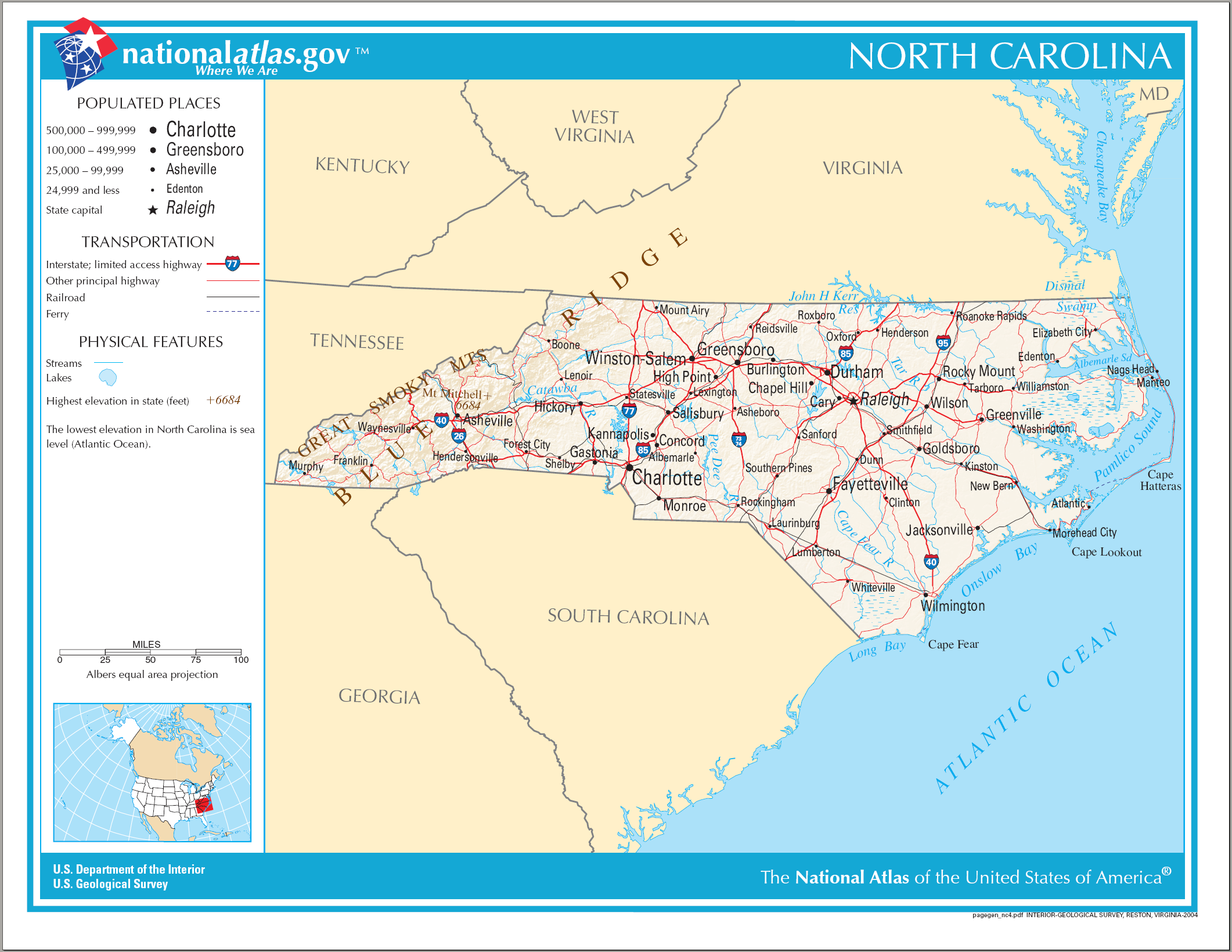
| Priskribo | Map of North Carolina |
| Dato | |
| Fonto | National Atlas |
| Aŭtoro | US Department of the Interior |
Permesiloj:
This map was obtained from an edition of the National Atlas of the United States. Like almost all works of the U.S. federal government, works from the National Atlas are in the public domain in the United States.
Online access: NationalAtlas.gov | 1970 print edition: Library of Congress, Perry-Castañeda Library
|
Dosierhistorio
Alklaku iun daton kaj horon por vidi kiel la dosiero tiam aspektis.
| Dato/Horo | Bildeto | Grandecoj | Uzanto | Komento | |
|---|---|---|---|---|---|
| nun | 21:37, 14 aŭg. 2006 | | 2 122 × 1 640 (1,21 MB) | Huebi~commonswiki | {{Information| |Description=Map of North Carolina |Source=[http://www.nationalatlas.gov National Atlas] }} Category:Maps of the United States Category:Maps of North Carolina {{PD-USGov-Atlas}} |
Dosiera uzado
La jenaj paĝoj ligas al ĉi tiu dosiero:
Suma uzado de la dosiero
La jenaj aliaj vikioj utiligas ĉi tiun dosieron:
- Uzado en ast.wikipedia.org
- Uzado en be.wikipedia.org
- Uzado en de.wikipedia.org
- Uzado en el.wikipedia.org
- Uzado en en.wikipedia.org
- Uzado en fi.wikipedia.org
- Uzado en fr.wikipedia.org
- Uzado en hr.wiktionary.org
- Uzado en hu.wikipedia.org
- Uzado en incubator.wikimedia.org
- Uzado en it.wikipedia.org
- Uzado en ja.wikipedia.org
- Uzado en lt.wikipedia.org
- Uzado en new.wikipedia.org
- Uzado en szl.wikipedia.org
- Uzado en zea.wikipedia.org
- Uzado en zh.wikipedia.org