Dosiero:Topography of new zealand.jpg

Grandeco de ĉi antaŭvido: 465 × 599 rastrumeroj. Aliaj distingivoj: 186 × 240 rastrumeroj | 540 × 696 rastrumeroj.
Bildo en pli alta difino ((540 × 696 rastrumeroj, grandeco de dosiero: 86 KB, MIME-tipo: image/jpeg))
| Jen dosiero de la Wikimedia-Komunejo. La priskribo en ties priskriba paĝo estas montrata suben.
|

|
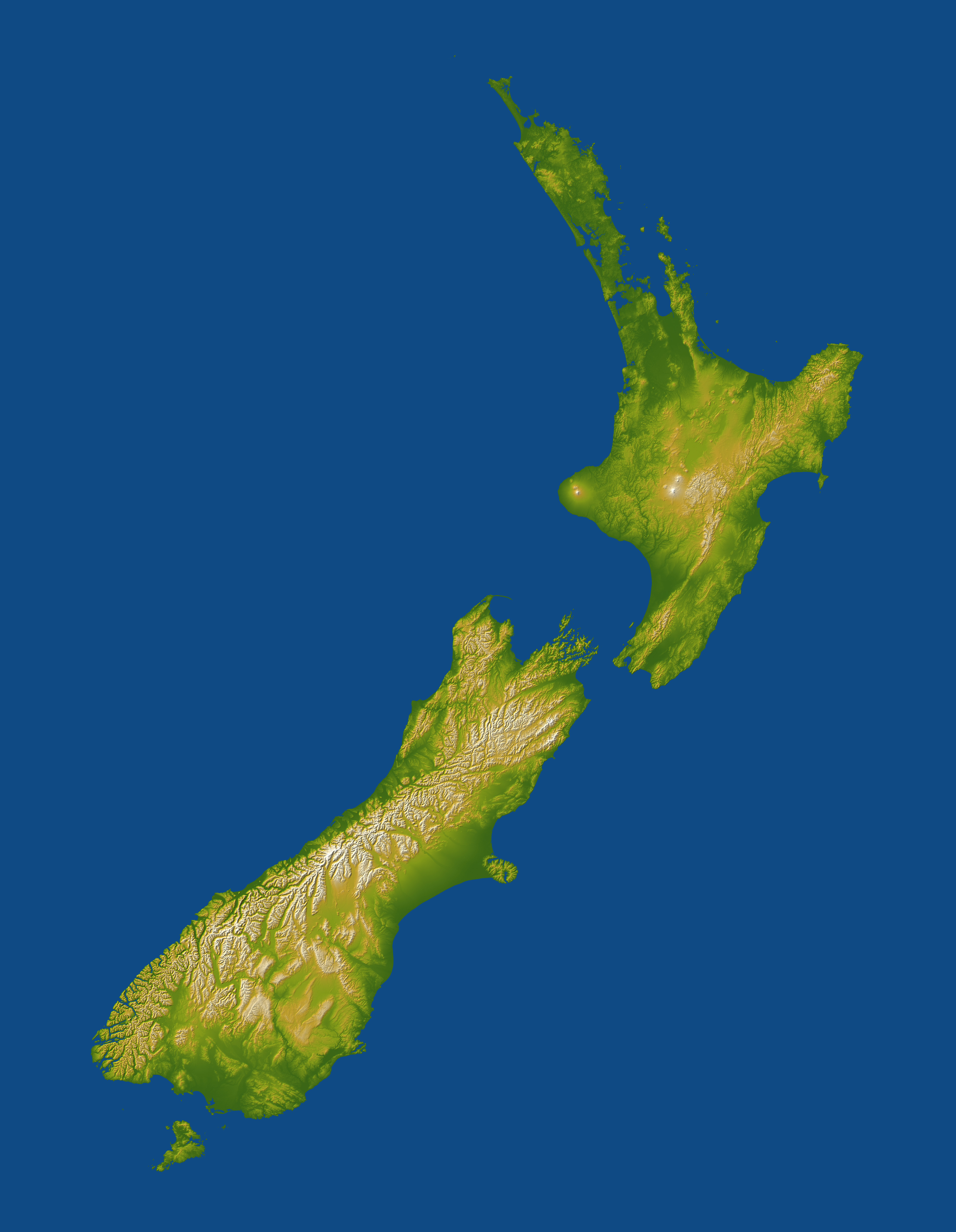
This map has been uploaded by Electionworld from en.wikipedia.org to enable the |
Topography of New Zealand. Lakes appear as flat areas but are not otherwise indicated.
For image description, see here.
For larger version, see here.
Image credit: NASA/JPL-Caltech
This image or video was catalogued by Jet Propulsion Laboratory of the United States National Aeronautics and Space Administration (NASA) under Photo ID: PIA06662. This tag does not indicate the copyright status of the attached work. A normal copyright tag is still required. See Commons:Licensing. Other languages:
|
| La ĉi-supra dosiero estas publika havaĵo, ĉar ĝi apartenas al NASA. La kopirajta regularo de NASA asertas, ke "ĉiuj dokumentoj de NASA estas publika havaĵo, se ne estas donata kontraŭa deklaro". | ||
 |
Atentu:
|
Dosierhistorio
Alklaku iun daton kaj horon por vidi kiel la dosiero tiam aspektis.
| Dato/Horo | Bildeto | Grandecoj | Uzanto | Komento | |
|---|---|---|---|---|---|
| nun | 23:10, 29 nov. 2006 | | 540 × 696 (86 KB) | Electionworld | {{ew|en|Darwinek}} Topography of New Zealand for image description see [http://earthobservatory.nasa.gov/Newsroom/NewImages/images.php3?img_id=16812 here] for larger version see [http://earthobservatory.nasa.gov/Newsroom/NewImages/Images/PIA06662_lrg.jp |
Dosiera uzado
La jena paĝo ligas al ĉi tiu dosiero:
Suma uzado de la dosiero
La jenaj aliaj vikioj utiligas ĉi tiun dosieron:
- Uzado en ar.wikipedia.org
- Uzado en ast.wikipedia.org
- Uzado en ca.wikipedia.org
- Uzado en ceb.wikipedia.org
- Uzado en cy.wikipedia.org
- Uzado en de.wikipedia.org
- Uzado en es.wikipedia.org
- Uzado en et.wikipedia.org
- Uzado en eu.wikipedia.org
- Uzado en fr.wikipedia.org
- Uzado en gl.wikipedia.org
- Uzado en hif.wikipedia.org
- Uzado en ja.wikipedia.org
- Uzado en ka.wikipedia.org
- Uzado en nl.wikipedia.org
- Uzado en no.wikipedia.org
- Uzado en ta.wikipedia.org
- Uzado en uk.wikipedia.org
- Uzado en wuu.wikipedia.org