Dosiero:1975 map of canal system in Lowell, Massachusetts.png
Grandeco de ĉi antaŭvido: 800 × 534 rastrumeroj. Aliaj distingivoj: 320 × 214 rastrumeroj | 640 × 428 rastrumeroj | 1 024 × 684 rastrumeroj | 1 280 × 855 rastrumeroj | 2 560 × 1 710 rastrumeroj | 3 371 × 2 252 rastrumeroj.
Bildo en pli alta difino ((3 371 × 2 252 rastrumeroj, grandeco de dosiero: 1,95 MB, MIME-tipo: image/png))
| Jen dosiero de la Wikimedia-Komunejo. La priskribo en ties priskriba paĝo estas montrata suben.
|
Resumo
| Priskribo |
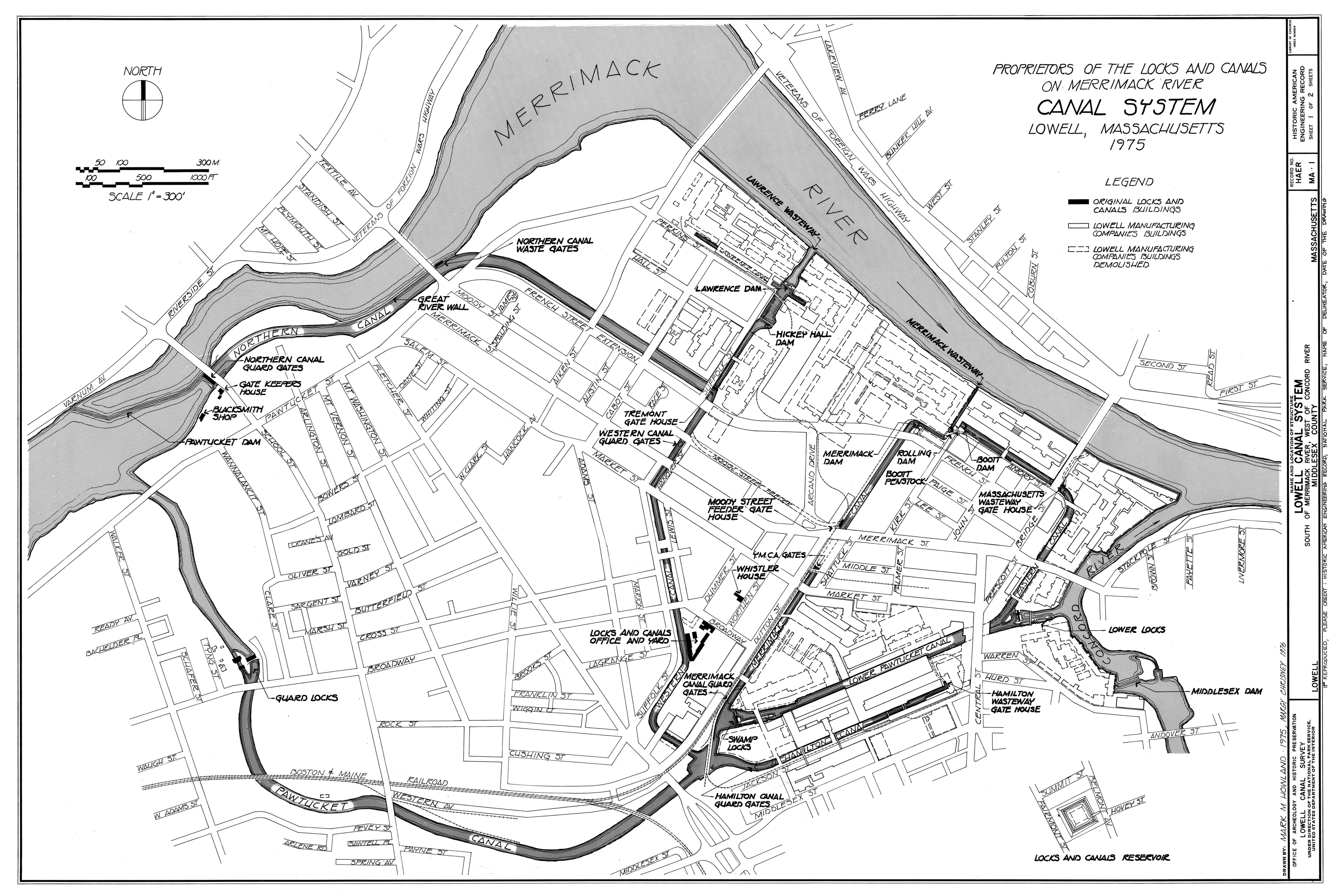
English: Canal system in Lowell, Massachusetts. Map as of 1975. |
|||||||||
| Fonto |
Lowell Canal System, Merrimack & Concord Rivers, Lowell, Middlesex County, MA, Historic American Engineering Record (Library of Congress), drawing 1. Image cropped to remove white space
|
|||||||||
| Kreinto |
Mark M. Howland, Margy Chrisney |
|||||||||
| Akirmaniero | Historic American Engineering Record, National Park Service, Mark M. Howland and Margy Chrisney, 1975 | |||||||||
| Permeso (Reuzo de la dosiero) |
|
|||||||||
| Geotemporal data | ||||||||||
| Montrata dato | ||||||||||
| Skalo | 1:3600 | |||||||||
| Heading |
 |
|||||||||
| Bounding box |
|
|||||||||
| Georeferencing | ||||||||||
| Bibliographic data | ||||||||||
| Map sheet | 1 | |||||||||

Dosierhistorio
Alklaku iun daton kaj horon por vidi kiel la dosiero tiam aspektis.
| Dato/Horo | Bildeto | Grandecoj | Uzanto | Komento | |
|---|---|---|---|---|---|
| nun | 03:12, 30 mar. 2011 | | 3 371 × 2 252 (1,95 MB) | Mikhail Ryazanov | 25% of the original size (to fit into 12.5 Mpix limit) |
| 03:02, 30 mar. 2011 |  | 13 485 × 9 006 (2,5 MB) | Mikhail Ryazanov | {{Information |Description ={{en|1=Canal system in Lowell, Massachusetts. Map as of 1975.}} |Source =Lowell Canal System, Merrimack & Concord Rivers, Lowell, Middlesex County, MA, Historic American Engineering Record (Library of Congress), draw |
Dosiera uzado
La jena paĝo ligas al ĉi tiu dosiero:
Suma uzado de la dosiero
La jenaj aliaj vikioj utiligas ĉi tiun dosieron:
- Uzado en de.wikipedia.org
- Uzado en en.wikipedia.org
- Uzado en sr.wikipedia.org
- Uzado en www.wikidata.org