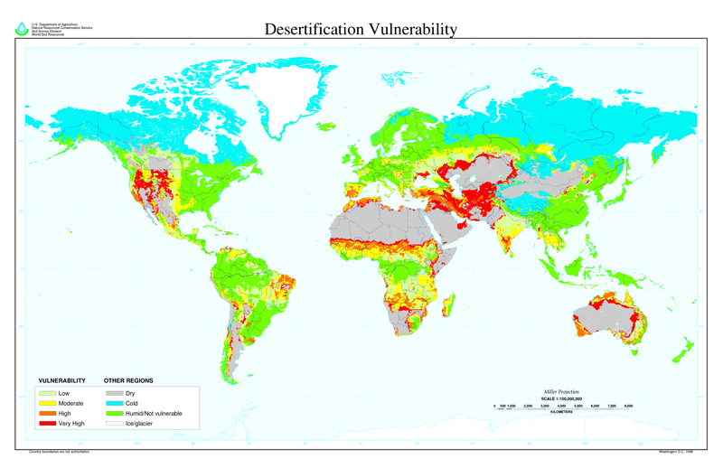
Dosiero:Desertification map.png

Grandeco de ĉi antaŭvido: 800 × 518 rastrumeroj. Aliaj distingivoj: 320 × 207 rastrumeroj | 640 × 414 rastrumeroj | 1 024 × 663 rastrumeroj | 1 280 × 828 rastrumeroj | 2 560 × 1 656 rastrumeroj | 6 800 × 4 400 rastrumeroj.
Bildo en pli alta difino ((6 800 × 4 400 rastrumeroj, grandeco de dosiero: 1,04 MB, MIME-tipo: image/png))
Dosierhistorio
Alklaku iun daton kaj horon por vidi kiel la dosiero tiam aspektis.
| Dato/Horo | Bildeto | Grandecoj | Uzanto | Komento | |
|---|---|---|---|---|---|
| nun | 11:01, 27 mar. 2022 |  | 6 800 × 4 400 (1,04 MB) | No.cilepogača | Reverted to version as of 00:12, 8 November 2006 (UTC) |
| 05:11, 8 nov. 2006 |  | 1 700 × 1 100 (558 KB) | Paleorthid | {{Information |Description=Global Desertification Vulnerability Map |Source=http://soils.usda.gov/use/worldsoils/mapindex/desert-map.zip |Date=1998 |Author=USDA employee |Permission=This image is a work of a United States Department of Agriculture employe | |
| 00:12, 8 nov. 2006 |  | 6 800 × 4 400 (1,04 MB) | Paleorthid | {{Information |Description=Global Desertification Vulnerability Map |Source=http://soils.usda.gov/use/worldsoils/mapindex/desert-map.zip |Date=1998 |Author=USDA employee |Permission=This image is a work of a United States Department of Agriculture employe |
Dosiera uzado
La jena paĝo ligas al ĉi tiu dosiero:
Suma uzado de la dosiero
La jenaj aliaj vikioj utiligas ĉi tiun dosieron:
- Uzado en ar.wikipedia.org
- Uzado en az.wikipedia.org
- Uzado en bg.wikipedia.org
- Uzado en bn.wikipedia.org
- Uzado en bo.wikipedia.org
- Uzado en ca.wikinews.org
- Uzado en ckb.wikipedia.org
- Uzado en cs.wikipedia.org
- Uzado en da.wikipedia.org
- Uzado en de.wikipedia.org
- Uzado en de.wiktionary.org
- Uzado en el.wikipedia.org
- Uzado en en.wikipedia.org
- Uzado en es.wikipedia.org
- Uzado en eu.wikipedia.org
- Uzado en fa.wikipedia.org
- Uzado en fi.wikipedia.org
- Uzado en fr.wikipedia.org
- Uzado en fr.wikinews.org
- Uzado en ga.wikipedia.org
- Uzado en he.wikipedia.org
- Uzado en hu.wikipedia.org
- Uzado en hy.wikipedia.org
- Uzado en id.wikipedia.org
- Uzado en is.wikipedia.org
- Uzado en it.wikipedia.org
- Uzado en ja.wikipedia.org
- Uzado en ko.wikipedia.org
Vidi plian ĝeneralan uzadon de ĉi tiu dosiero.
