Dosiero:Mo-hwy-sys.png
Jen estas la maksimuma distingivo de la supra bildo.
Mo-hwy-sys.png ((763 × 586 rastrumeroj, grandeco de dosiero: 41 KB, MIME-tipo: image/png))
| Jen dosiero de la Wikimedia-Komunejo. La priskribo en ties priskriba paĝo estas montrata suben.
|
Resumo
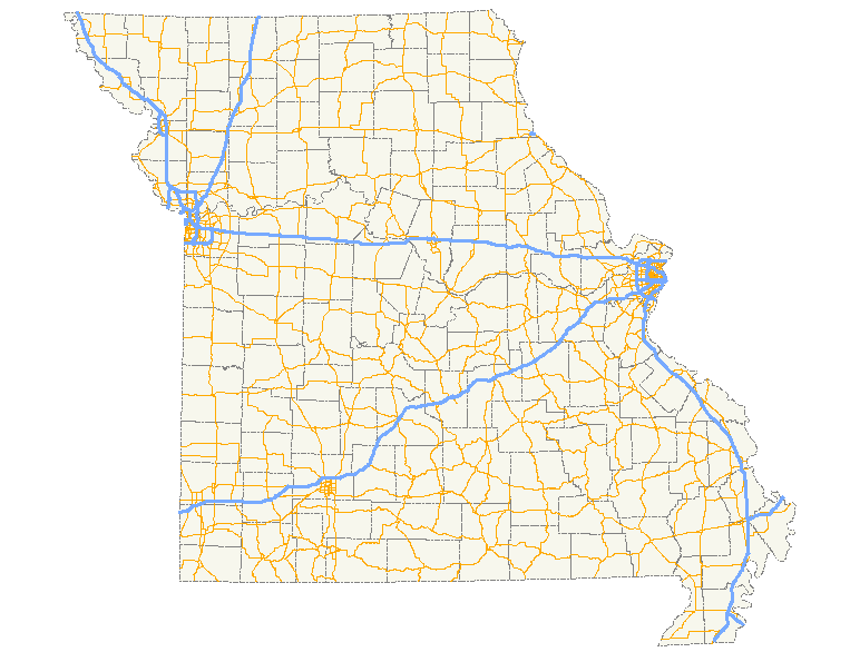
| Priskribo | A map showing the path of all numbered state highways in Missouri. |
| Dato | |
| Fonto | Created by me in Quantum GIS 0.8.1 based on data collected from the Census Bureau (the county outlines) and the Federal Highway Administration (the roads). |
| Aŭtoro | Scott Nazelrod |
| Permeso (Reuzo de la dosiero) |
Public domain, credit appreciated but not required |
Permesiloj:
| Mi, la posedanto de la aŭtorrajto por ĉi tiu verko, liberigas ĝin tutmonde kiel publikan havaĵon. En iuj landoj tio povas esti laŭleĝe neebla; en tiu okazo: Mi rajtigas ĉiun ajn uzi ĉi tiun verkon por ajna celo, sen iuj ajn kondiĉoj, krom se tiuj kondiĉoj estas postulataj per leĝo. |
Dosierhistorio
Alklaku iun daton kaj horon por vidi kiel la dosiero tiam aspektis.
| Dato/Horo | Bildeto | Grandecoj | Uzanto | Komento | |
|---|---|---|---|---|---|
| nun | 07:52, 15 aŭg. 2007 | | 763 × 586 (41 KB) | Scott5114 | == Summary == {{Information |Description=A map showing the path of all numbered state highways in Missouri. |Source=Created by me in Quantum GIS 0.8.1 based on data collected from [http://www.census.gov/geo/www/cob/co2000.html the Census Bureau] (the cou |
Dosiera uzado
La jena paĝo ligas al ĉi tiu dosiero: