Dosiero:Roanoke NASA World Wind.jpg

Grandeco de ĉi antaŭvido: 800 × 592 rastrumeroj. Aliaj distingivoj: 320 × 237 rastrumeroj | 640 × 474 rastrumeroj | 1 024 × 758 rastrumeroj | 1 280 × 948 rastrumeroj | 1 383 × 1 024 rastrumeroj.
Bildo en pli alta difino ((1 383 × 1 024 rastrumeroj, grandeco de dosiero: 1,26 MB, MIME-tipo: image/jpeg))
| Jen dosiero de la Wikimedia-Komunejo. La priskribo en ties priskriba paĝo estas montrata suben.
|
Resumo
| Priskribo |
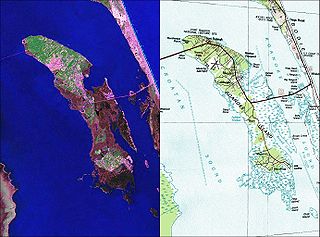
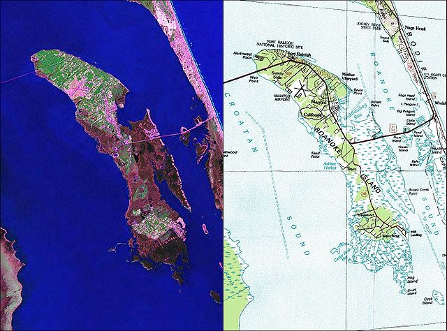
English: NASA World Wind Geocover 2000 and topographic map coverage of Roanoke Island, North Carolina |
| Dato | 2000-aj jaroj |
| Fonto | NASA World Wind Screen Shot |
| Aŭtoro | NASA |
Permesiloj:
This image is in the public domain in the United States because it only contains materials that originally came from the United States Geological Survey, an agency of the United States Department of the Interior. For more information, see the official USGS copyright policy.
|
Dosierhistorio
Alklaku iun daton kaj horon por vidi kiel la dosiero tiam aspektis.
| Dato/Horo | Bildeto | Grandecoj | Uzanto | Komento | |
|---|---|---|---|---|---|
| nun | 12:35, 26 maj. 2010 | | 1 383 × 1 024 (1,26 MB) | Ratzer | {{Information |Description={{en|1=NASA World Wind Geocover 2000 and topographic map coverage of Roanoke Island, North Carolina}} |Source=NASA World Wind Screen Shot |Author=NASA |Date=2000s |Permission= |other_versions= }} [[Category:Maps of North Caroli |
Dosiera uzado
La jena paĝo ligas al ĉi tiu dosiero:
Suma uzado de la dosiero
La jenaj aliaj vikioj utiligas ĉi tiun dosieron:
- Uzado en ca.wikipedia.org
- Uzado en ceb.wikipedia.org
- Uzado en de.wikipedia.org
- Uzado en en.wikipedia.org
- Uzado en es.wikipedia.org
- Uzado en hu.wikipedia.org
- Uzado en ja.wikipedia.org
- Uzado en ko.wikipedia.org
- Uzado en nl.wikipedia.org
- Uzado en pl.wikipedia.org
- Uzado en pt.wikipedia.org
- Uzado en ru.wikipedia.org
- Uzado en www.wikidata.org
- Uzado en zh.wikipedia.org