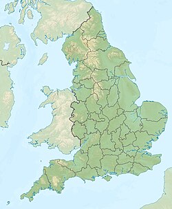
East Riding of Yorkshire
unuara instanco en la angla regiono Yorkshire and the Humber
East Riding of Yorkshire estas unuara instanco en la angla regiono Yorkshire and the Humber.

| East Riding of Yorkshire | |||
|---|---|---|---|
| unuara instanco | |||
 | |||
| ceremonia kantono de Anglio [+] | |||
| Lando | Anglio | ||
| Koordinatoj | 54° N, 1° U (mapo)53.916666666667-0.5Koordinatoj: 54° N, 1° U (mapo) | ||
| - koordinatoj | 54° N, 1° U (mapo)53.916666666667-0.5Koordinatoj: 54° N, 1° U (mapo) [+] | ||
| Akvokolektejo | 2 476,77 km² (247 677 ha) [+] | ||
| Areo | 2 476,77 km² (247 677 ha) [+] | ||
| Loĝantaro | 602 327 [+] (2020) | ||
| Horzono | UTC±00:00, UTC+01:00 [+] | ||
| ISO 3166-2 | GB-ERY | ||
|
|||
 |
|||
| East Riding of Yorkshire | |||
| En TTT: Oficiala retejo [+] | |||
Loĝantaro - 602 327 (en 2020)
Areo – 2 415 km²
Urboj kaj vilaĝoj
redakti- Beverley, Bridlington, Broomfleet, Burnby, Burton Agnes
- Driffield
- Everingham
- Flamborough, Fridaythorpe
- Gilberdyke, Grimston
- High Catton, High Hunsley, Highfield, Holme-on-Spalding-Moor, Hornsea, Howden, Hutton, Hull
- Kirk Ella
- Langtoft, Laxton, Long Riston
- Market Weighton, Mappleton, Marton
- Nafferton, North Cave, North End, North Ferriby, North Howden
- Pocklington
- Sewerby, Skidby, Skipsea, Snaith, South Cave, Stamford Bridge
- Withernsea
Vizitindaĵoj
redakti- Burnby Hall
- Burton Agnes Manor House, Burton Agnes Hall
- Sewerby Hall
- Skipsea Castle
- Beverley Minster and Beverley Friary
- Howden Minster
- Skidby Working Windmill
- Hornsea Mere
- rivero Humber, ponto Humber, River Hull, Watton Beck, River Derwent, Yorkshire, River Ouse, River Aire, River Trent
- Aire and Calder Navigation
- Driffield Canal
- Leven Canal
- Market Weighton Canal
- Pocklington Canal
- Yorkshire Wildlife Trust
- Flamborough Head
- Spurn
Eksteraj ligiloj
redakti- http://www.eastriding.gov.uk/ - nur angle


